AGRI-PROFILE: BONGABONG, ORIENTAL MINDORO
Bongabong, Oriental Mindoro
Bongabong is one of the third largest municipalities in the province of Oriental Mindoro with a total land area of 49,820 hectares or 498.2 square kilometers. It is a first class municipality composed of 36 barangays, five of which are considered urban barangays including Aplaya, Poblacion, Bagong Bayan 1, Bagong Bayan 2 and Ipil while the rest (31) are rural barangays. The table below shows the distribution of land area by Barangay.
Crop Production and Land Utilization by type
Rice Production
The agricultural land planted to rice totals 5,429.50 hectares, 74.70% of it are irrigated and 25.29% are either lowland rain fed or upland rain fed. Barangays Anilao, Malitbog, Libertad, and Masaguisi have the biggest land area devoted to rice production, all of which are irrigated.
At the end of CY 2012, total palay production for the municipality was recorded at 23,737.25 metric tons of which 18,245.25 or 76.86% were produced from irrigated rice lands. In terms of share to total palay production, the leading barangays were Barangays Anilao, Malitbog, Libertad, Masaguisi, Dayhagan and Ogbot all of which are irrigated. While the remaining 23.14% or 5,492 metric tons were produced from non-irrigated rice lands.
Banana Production
Banana accounts 26% of the total land area planted to agricultural crops, making it one of the top fruit product of Bongabong. Barangay Carmundo has the largest land area planted to banana followed by Tawas, Sagana and Formon.
As of 2012, the municipality recorded the production at 57, 432 metric tons with Barangay Tawas, Carmundo and Sagana as the top banana producing barangays. However, it should be noted that although large quantities of bananas are produced in the municipality, these are all exported. Manufacturing of banana products is very minimal.
Industrial Crops Production
Bongabong is one of the major coconut producers in Oriental Mindoro. During 2012, a total of 6,475 hectares of the agricultural land in Bongabong is planted with coconut. This represents a total of 35% of the agricultural land.
Coconut production ranges to 64,750 metric tons. Top 5 barangays in terms of land area are Luna, San Isidro, San Juan, Kaligtasan and Bukal according to the Municipal Agriculture Office. Data from the Philippine Coconut Authority reveals that there are existing 519,929 coconut trees, 347,275 or 67% of it are bearing trees. Almost 75% of the coconuts bearing trees are over 30 years of age, while most of the non-bearing trees belong to 4-5 years age group. Average production per tree in a year is recorded at 40 nuts. Estimated number of coconut trees cut is 2,360 or an equivalent area of 22.48 hectares.
| Major Crops | Area(ha) | Production (mt) | Product Market,Export | ||||
| 2010 | 2012 | Inc/Dec | 2010 | 2012 | Inc/Dec | ||
| 1. Rice | |||||||
| Irrigated | 4,086.50 | 4,086.50 | 0 | 16,346 | 18,245.25 | 1,899 | Bongabong & Gloria |
| Non-Irrigated | 823.50 | 1,373 | 550 | 3,294 | 5,492 | 2,198 | Bongabong & Gloria |
| 2. Coconut | 4,517 | 6,475 | 1,958 | 18,068 | 64,750 | 46,682 | Lucena |
| 3. Banana | 3,351 | 4,786 | 1,435 | 13,404 | 57,432 | 44,028 | Manila |
| 4. Others | 480 | 1,673 | 1,193 | 1,920 | 8,365 | 6,445 | Manila |
| Total | 13,258 | 18,393.50 | 5,135.50 | 53,032 | 154,284.25 | 101,252.25 | |
Livestock and Poultry Production
In terms of livestock production, there were cattle, swine, carabao, and goat raise by livestock farmers both backyard and commercial classification. Commercial chicken and ducks has also become the source of livelihood for some poultry farmers however there are several households raising for home consumption only.
Comparative Agricultural Crop Areas and Production by Type (Year 2010-2012)
| TYPE | AREA | CLASSIFICATION | VOLUME | VALUE |
|---|---|---|---|---|
| Livestock | ||||
| Cattle | 455 has. | Commercial | 1466 | |
| 81 has. | Backyard | 3240 | 81,000,000 | |
| Swine | 4 has. | Commercial | 899 | 37,220,000 |
| Carabao | 7.44 has. | Backyard | 1861 | |
| Goat | 231.95m2 | Backyard | 4639 | 6,958,500 |
| Poultry | ||||
| Layer | 1.5 has. | Commercial | 2410 | |
| Broiler | .5 ha. | 10,000 | ||
| Malalard/muscoby /ducks | 2.25has. | Commercial | 4874 |
Fisheries and Aquaculture
Fishing is another source of livelihood in the coastal population of Bongabong. Varied fishing products abound in coastal barangays’ fishing grounds. These coastal barangays include Labasan, Aplaya, Poblacion, Anilao, Masaguisi, Cawayan, Camantigue and Dayhagan.
Marine protected area is located in barangay Masaguisi. Fishing grounds and aquaculture areas were also established in these coastal barangays. Among these coastal barangays, Aplaya has the greatest production of fisheries with a value of 9,950 and Dayhagan with 36.720M production value on aquaculture. There were coral reefs inside the protected area where the aquatic and marine habitat lived which provides fishes to lay their eggs resulting to the increase of fish catch for the years to come. There are 167 hectares of mangroves in the coastal barangays.
| FISHING GROUNDS | BARANGAY | PRODUCTION | PRODUCT MARKET | ||
| Vol | Value | Local | Export | ||
| FISHERIES | |||||
| Labasan | 97 kgs. | 860 | 10,670 | 11,640 | |
| Anilao | 55 | 9,950 | 6,050 | 6,600 | |
| Aplaya | 107.5 | 9,675 | 11,825 | 12,840 | |
| Poblacion | 37.5 | 2,375 | 4,125 | 4,500 | |
| Masaguisi | 73 | 6,570 | 8,030 | 8,760 | |
| Cawayan | 42.5 | 3,825 | 4,675 | 5,180 | |
| Camantigue | 45 | 4,050 | 4,650 | 5,400 | |
| Dayhagan | 75 | 6,750 | 8,250 | 9,000 | |
| AQUA | |||||
| Labasan | 21,200 | 2.614M | 3.020 | 3.286 | |
| Poblacion | 31,000 | 4.600M | 5.350 | 5.750 | |
| Anilao | 159,000 | 19.980M | 22.650M | 24.510M | |
| Masaguisi | 40,800 | 6.691M | 7.680M | 8.232M | |
| Cawayan | 20,800 | 3.006M | 3.430M | 3.692M | |
| Camantigue | 60,200 | 8.820M | 10.070M | 10.834M | |
| Dayhagan | 261,000 | 36.720M | 41.850M | 45.890M | |
| Ipil | 20,000 | 3.056M | 3.430M | 3.642M | |
| Malitbog | 29,200 | 4.140M | 4.720M | 5.084M | |
With regards to Strategic Agriculture and Fishery Development Zone, the local government of Bongabong failed to adopt its SAFDZ for the last ten (10) years because of the inaccurate maps/data showing the position of the prime agricultural lands and water uses. Using GPS instrument and DENR maps, the prime agricultural lands, fishery and other land uses are identified and overlay in the maps. It is therefore, the urban expansion is easily drawn. Out of 49,820 hectares, 9.87% or 4,919.17 hectares represent the total prime agricultural lands and the protected forest of 19, 101.67 hectares which is not negotiable for urban development. Therefore the total buildable areas suitable for land conversion are about 46.39% or 23,113.66 hectares that composed of the marginal agricultural area and grasslands/pastures.
Forestry Production
The municipality has a total area of 28,377.70 hectares classified as forest/public lands or 57.42% of its total land area. Production forest which is devoted mainly for the production of forest products (both timber and non-timber) covers 16,325 hectares or 57.53% of the total area of forest lands. These production forests were in Barangay Batangan, Lisap, Hagan, Tawas, Formon and Mapang.
Protected areas are found in the upland forest of Barangay Lisap, Batangan, Hagan and some part of Morente comprising 14,457.70 hectares or 50.94% of the total forest land. These areas require special protection from human intrusion due to its sensitive and critical ecosystems so as to preserve the integrity to allow degraded areas to regenerate as well as to protect human population from environmental hazards. These protected areas play a very important role in the economic survival of the municipality.
| CATEGORY | LOCATION | AREA (Has.) |
| A. Production Forests | ||
| 1. Timber Production (natural) | 2,369.00 | |
| 2. Timber Production (Plantation) | Batangan, Lisap, Hagan, Tawas, Formon, Mapang | 2,311.00 |
| 3. Agro-Forest | - | |
| 4. Pasture/Grazing Land | ||
| 5. Mineral Areas | Along Bongabong River | 3,606 |
| 6. Watershed Areas | ||
| 7. CBFM other special | Formon, Sigange, Hagan, Mapang, Morente | 1,163.09 |
| B. Protection Forest | ||
| 1. NIPA’S Area | Lisap, Batangan, Hagan | 7,962.72 |
| 2. Non-NIPA’s Area | Lisap, Batangan, Morente, hagan | 6,494.98 |
| GRAND TOTAL | 28,377.70 | |
| Source: Department of Environment and Natural Resources(DENR) | ||
Post-Harvest Facilities and Support Systems
Considering that agriculture is the major source of livelihood of the residents of Bongabong, several agricultural support programs were established to provide technical assistance. The municipality has supported the construction of much of this physical infrastructure within agriculture and forestry. Among other things, this infrastructure includes agricultural support facilities and services such as millings, multi-purpose drying pavements (MPDP) and warehouses; and transportation networks including farm-to-market roads used in transporting goods and services to and from the farm. Most of these facilities were operational.
Post-harvest facilities include 15 rice mills, 72 multi-purpose drying pavements (mpdp) in 15 barangays and 46 warehouses situated in 12 barangays of Bongabong. However there is no existing trading center for agricultural crops in themunicipality.
| POST HARVEST FACILITIES & SUPPORT SERVICES | LOCATION | No. | TYPE /CAPACITY | % UTILI -ZATION | REMARKS |
| Milling | 15 | 36 | 20 bags per hr. | 80% | Operational |
| MPDP | 15 brgys | 72 | 100 cavans 50 cavans | 90% | Operational |
| Market Centers | - | - | - | - | - |
| Warehouse | 12 brgys | Ordinary | 80% | ||
| 39 | 1,000 bags | Operational | |||
| 2 | 1,000 bags | Need Repair | |||
| 1 | 50,0000 bags | Operational | |||
| 1 | 3,000 bags | Operational | |||
| 1 | 10,000 bags | Operational | |||
| 2 | 20,000 bags | Operational | |||
| Others | - | - | - | - | - |
| Source: Municipal Planning and Development Office | |||||
Agricultural support program and loans/credit facilities also sustain the need of agricultural farmers. There were farmers’ cooperatives in the municipality that supports the farmers. Most of these financing institutions are situated at Poblacion and some in other barangays such as the Bansud-Bongabong lending Corporation in Barangay Aplaya and the Mina de Oro ARB’s Multi-purpose Cooperative(MAREBEMCO) in Mina de Oro.
Physical Infrastructure
| ACTIVITIES | 2010 | 2011 | 2012 | |||
| Area | % | Area | % | Area | % | |
| Crop Production | 16,739 | 90.144 | 18,081 | 90.536 | 18,234 | 90.329 |
| Livestock/Poultry | 430 | 2.315 | 490 | 2.453 | 552 | 2.734 |
| Fishing | 1400 | 7.539 | 1400 | 7.01 | 1400 | 6.935 |
| Forest Product | - | - | - | - | - | - |
| Total | 18,560 | 99.99 | 19,971 | 99.99 | 20,186 | 99.99 |
Source: Municipal Agriculture Office of Bongabong, Oriental Mindoro
Municipalities

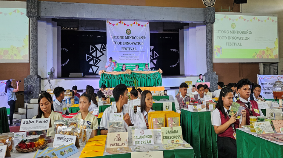
Food Innovation Festival 2023: Lutong Mindoreño

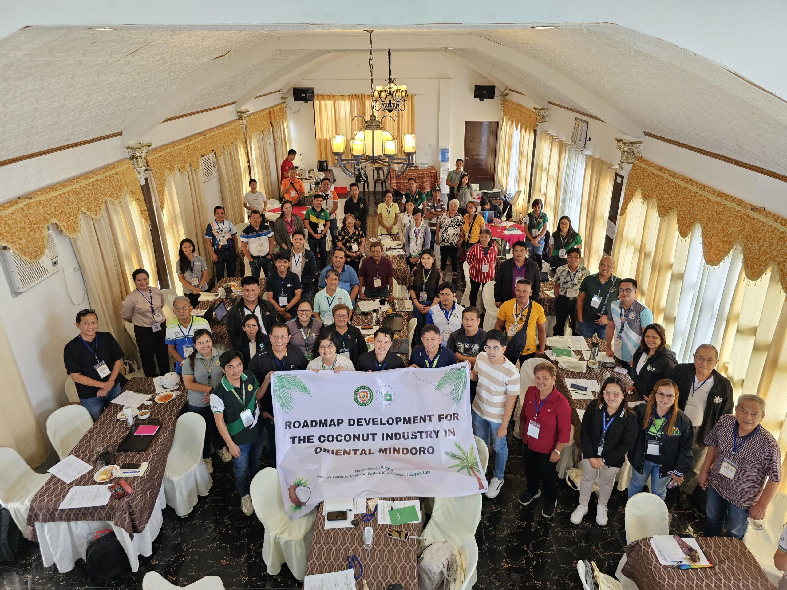
PAGO, ATI pursues Roadmap for Oriental Mindoro Priority Commodities

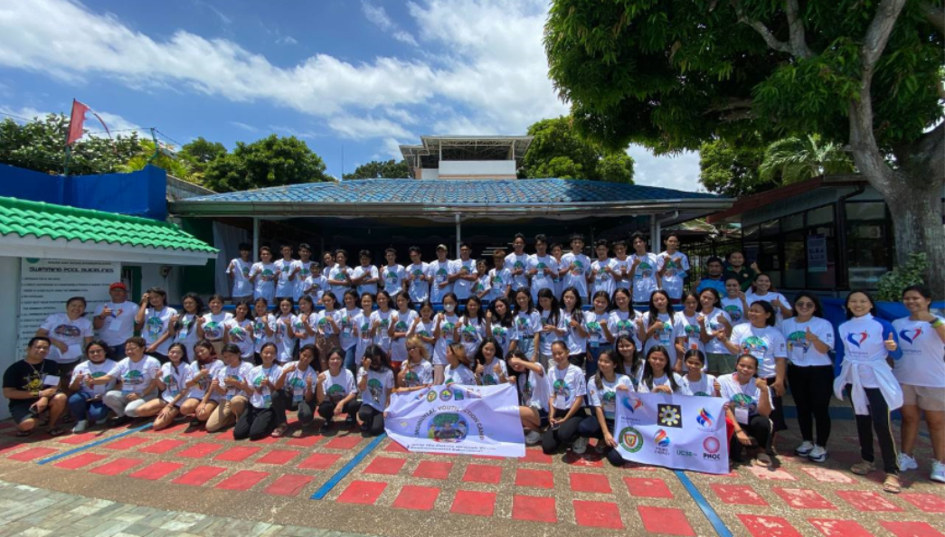
PAGO, MFI Raise MPA Awareness Among Youth

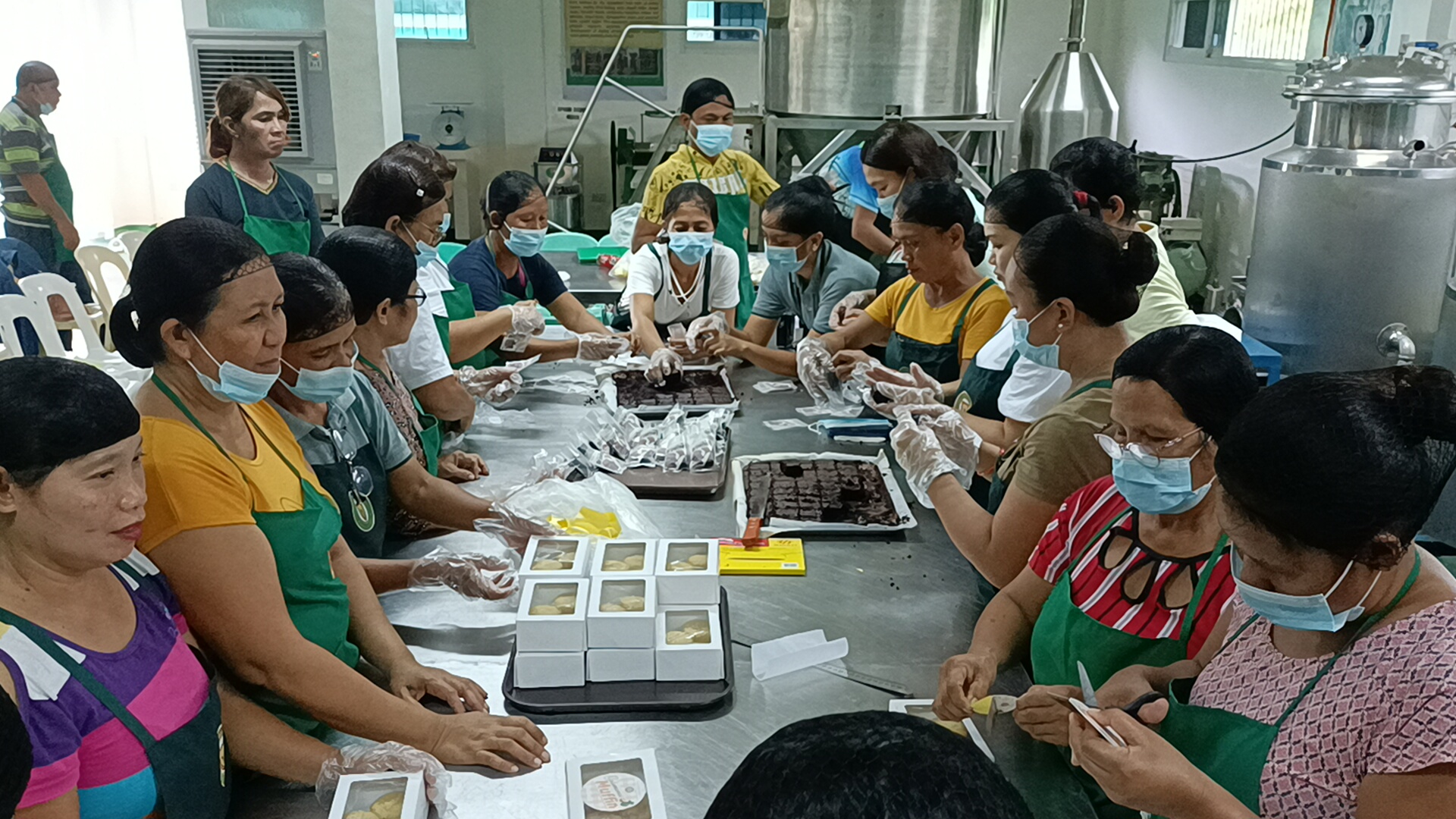
PAGO Empowers Farmers through Innovative Processing Technique
Subscribe to our AgriInfoHub newsletter and receive the latest updates, expert insights, and valuable tips to cultivate success on your farm.
